AUSTIN, Texas — We've had a warm and muggy week so far, and that pattern should continue through the remainder of the workweek. However, by Friday, we could start to see some changes.
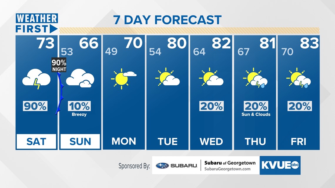
These will come in the form of not only some good rainfall totals, especially for areas that need it, with strong to severe storms on Saturday evening, but also a big cooldown. It will likely be the last cooldown before Central Texans endure a very warm next several months.
This is because a frontal boundary comes in Thursday with a line of storms that could be strong Thursday night into Friday. That front is slated to lift back north as we head through the day on Friday. This will allow for more moisture to come in from the Gulf of Mexico and bring storm chances on Saturday evening as it makes its final passage through Central Texas.
In addition to the heavy rainfall expected on Saturday for most of Central Texas, especially the Hill Country, we're tracking highs that may not reach 80 for Saturday as radiational heating is limited by the rain. Sunday's highs might not reach 70 due to the northerly flow behind the strong cold front.

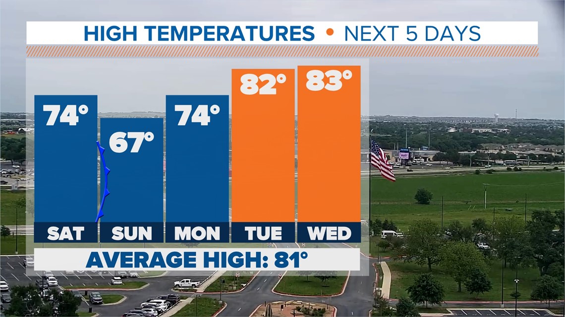
As for lows, we are tracking lows in the 50s for Saturday and Sunday evening. Highs on Monday should rebound back to the mid-70s, then around 80 for the middle of next week.
Stick with KVUE as we continue to track how cool we get.
Your extended forecast is below: