
AUSTIN, Texas — Happy Thursday!
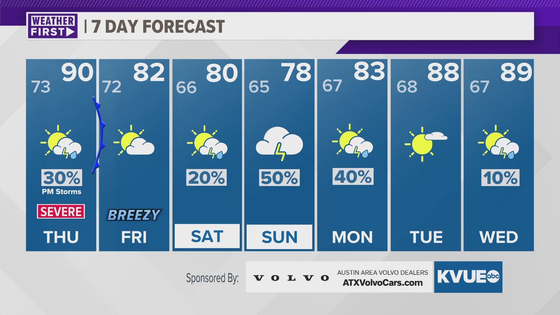
We didn't actually hit our warmest day of 2024, as Mexico's agricultural burning and cloud coverage prevented temperatures from getting warm enough to reach that mark. However, we are holding that possibility for Thursday afternoon with highs in the lower 90s. There is a caveat, and that there's a conditional risk for severe weather, even though most of the KVUE area is now under that 3 out of 5 "enhanced" risk, with hail and damaging winds being the main threats. A tornado can't be ruled out, but the chances of that are very low.
As we head into the weekend, we have better storm chances for Saturday and Sunday and even into Monday morning as well, before we dry out for most of next week.
THURSDAY MORNING:
Muggy and cloudy. Patchy fog possible late. South wind at 5 to 10 mph.
LOW: 73
THURSDAY:
Partly sunny, hot, and humid. 30% late PM storms, some of which could be strong. South wind at 5 to 10 mph. Heat index up to 102°F.
HIGH: 92
THURSDAY NIGHT:
Muggy and cloudy. Patchy fog possible late. South wind at 5 to 10 mph.
LOW: 69
7-DAY FORECAST:


Check out the live radar for what you can expect the rest of the day and into the workweek.