
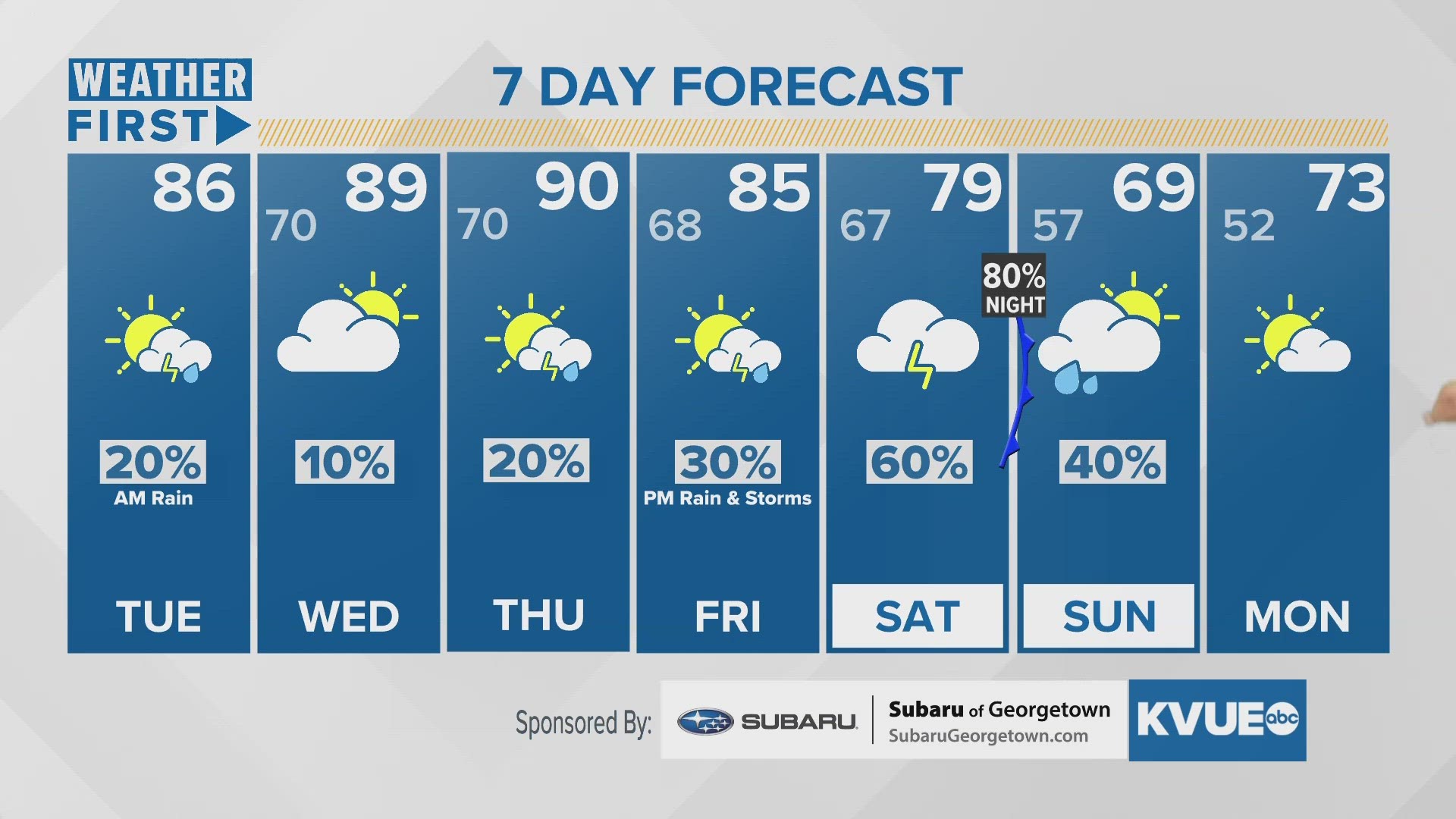
AUSTIN, Texas — Tuesday brings in more heat, humidity, and rain chances. For the morning and early afternoon, the KVUE Storm Team will be tracking a slow-moving front, which is now stalled over Central Texas for a bit. By about 3 or 4 p.m. rain chances are expected to nod off.
However, they will resurge each day through the end of the week. Wednesday will again be majority cloudy, but we can't rule out a few scattered showers. Amidst the humidity Wednesday through Friday, there will also be hot afternoons, with a few areas suspected to hit 90°F. This will make the air outside quite soupy and uncomfortable.
Thursday has a similar forecast. But, our next front enters the region Friday evening, giving way to a more significant chance for rain, and maybe a few thunderstorms.
Saturday night into Sunday morning will be the next round of stormy weather, which should bring some widespread rain to the region, but again may pose severe weather threats. It's still a bit early the hash out details. But what we can say is, that the cold front associated with this weekend's wet weather will then cool us down to the mid-70s to start off next Monday.