
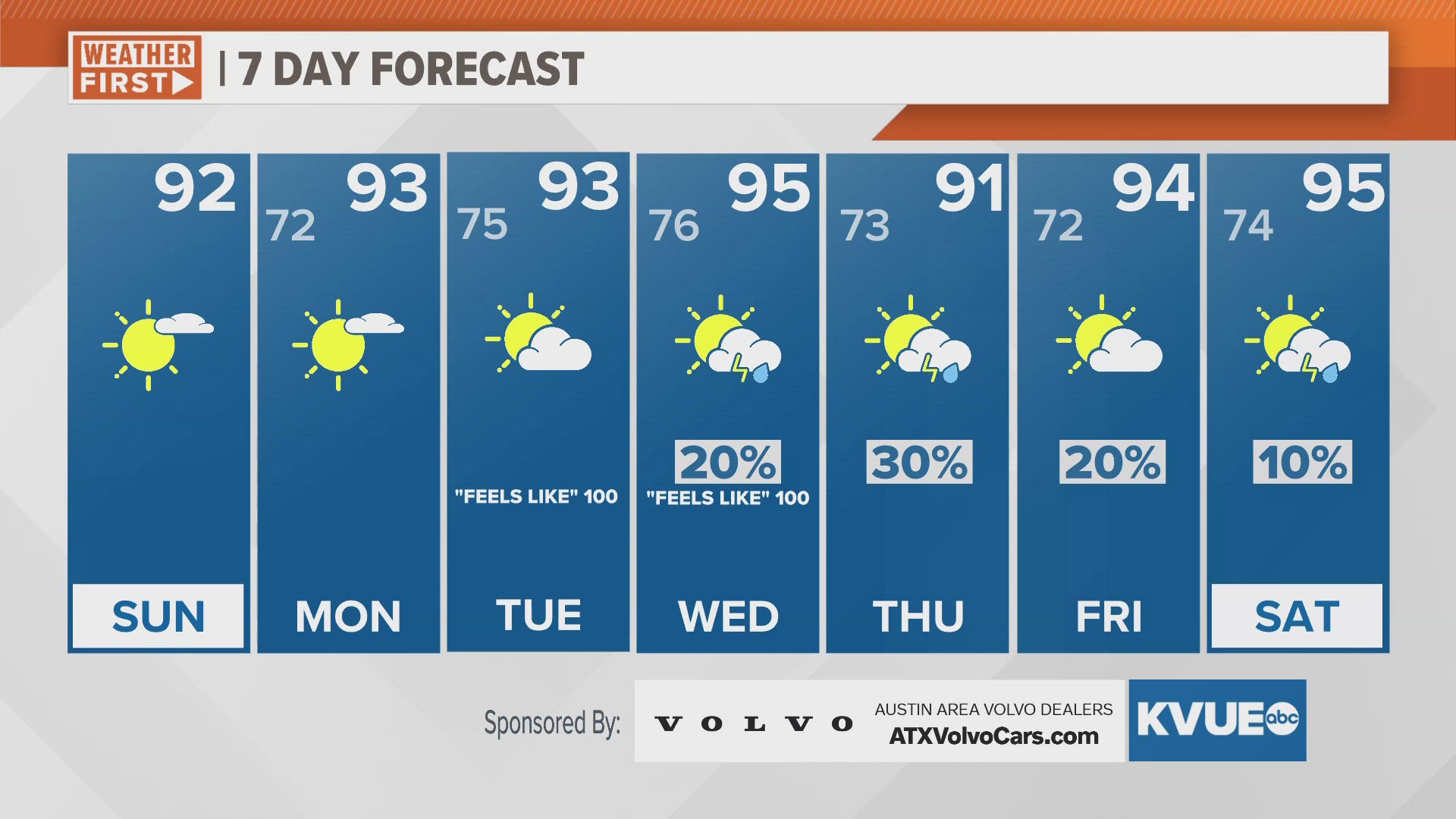
AUSTIN, Texas — Misty and cloudy conditions Sunday morning will quickly burn off as temperatures shoot upwards once again. Highs Sunday afternoon will reach the 90s again. Humidity is also set to trend upwards too, and be prepared for a soupy week.
Monday's conditions will look similar, and humidity will really increase on Tuesday and Wednesday as the heat index, or "feels-like" temperatures, rise toward 100 degrees. By midweek, a frontal boundary will push across the Lone Star State, leading to isolated storm and shower activity Wednesday through Friday.
It's possible rain chances continue into next weekend, but details are too far out for now. Temperatures should take a slight dip Thursday, with the added 30% to 40% chance for rain, but washout conditions are not expected.
A reminder that the UV index has now risen to the high-extreme categories the past few days, and if you are spending a long amounts of time outside this week, you'll need sun protection.
SUNDAY:
Mostly sunny, hot and humid. Southwest wind at 5 to 15 mph.
HIGH: 93
SUNDAY NIGHT:
Mostly clear. Patchy fog late. South wind at 5 to 10 mph.
LOW: 73
SEVEN-DAY FORECAST:


Check out the live radar for what you can expect the rest of the day and into the workweek.