
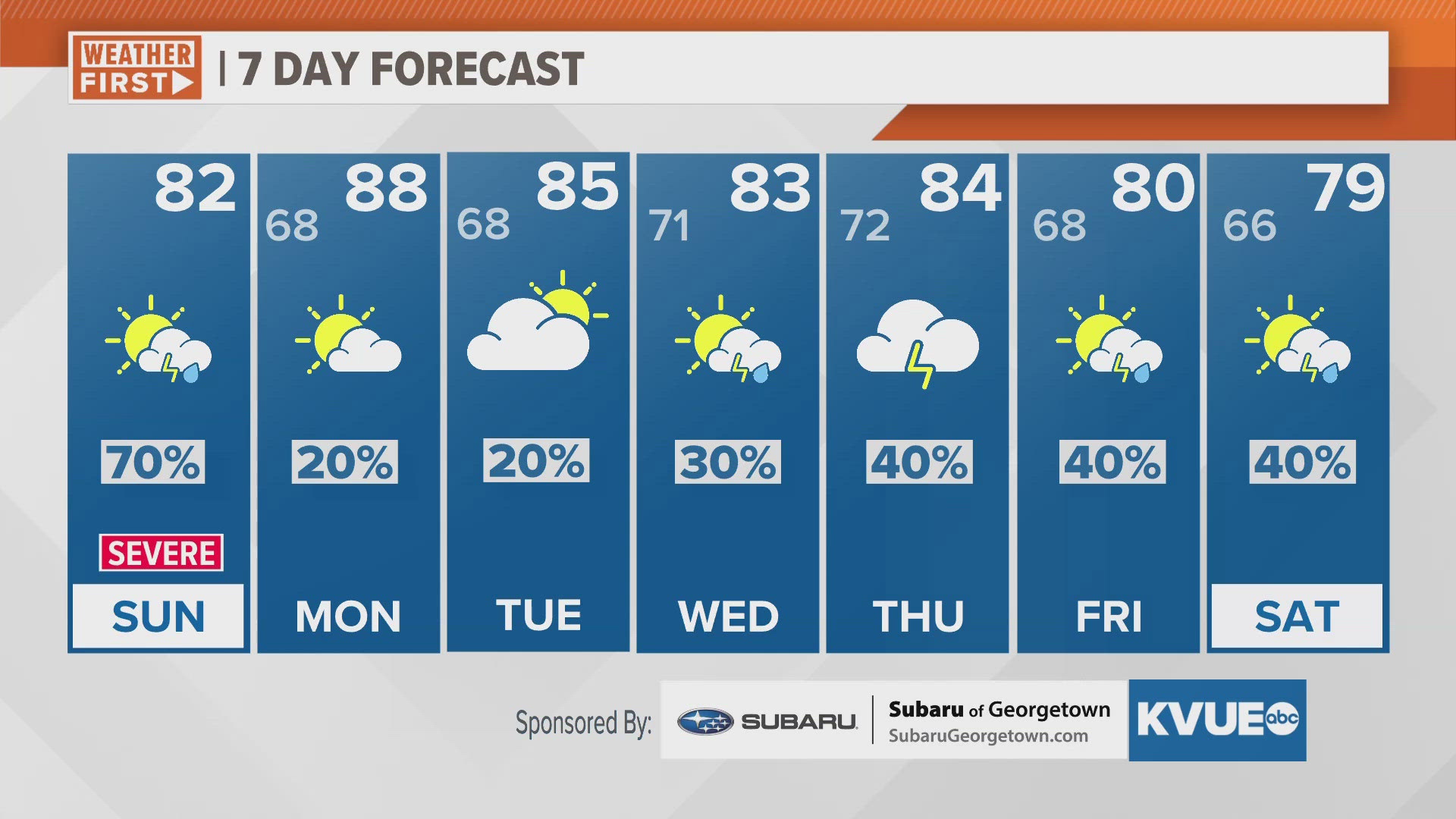
AUSTIN, Texas — The KVUE Weather Team is monitoring a line of showers and storms pushing through Central Texas Sunday morning. Some storms could be strong and could contain large hail, damaging wind, and isolated tornadoes.
Showers and storms arrived late Saturday night and continue to push east Sunday morning into the early afternoon. Storms will continue to weaken through the back half of the morning, but could potentially strengthen again for areas north and east of Austin for the early afternoon.
The National Weather Service has outlined the Hill Country with a slight risk for severe storms, a level 2 out of 5 for early Saturday morning. However, this slight risk will shift east of I-35 after sunrise and will include Milam and Lee counties.
Temperatures start in the 60s to lower 70s Sunday morning and climb to the lower 80s for Austin. Clearing occurs from west to east and will allow our Hill Country counties to trend warmer in the mid-80s. Slightly breezy conditions are expected with sustained winds at 10 to 20 mph.
Warm conditions continue overnight with lows in the upper 60s. Patchy fog could potentially develop for Monday morning commuters.
An unsettled weather pattern lingers through Central Texas for at least the first half of the workweek with daily rain and storm chances in the forecast. While chances will only be isolated to lightly scattered for Monday and Tuesday, our chances will be on the rise for the middle and back half of the week.